Halifax Water is proud to provide a gallery of maps, mapping applications, and relevant mapping resources for public access. Use these to learn more about our services, infrastructure, major projects and more.
Stormwater Services
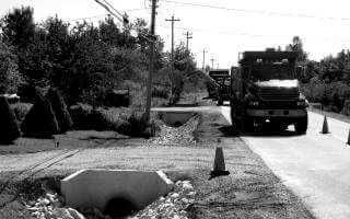
Stormwater is the water from rain, melted snow and ice, that runs off roofs, parking lots, driveways, and other hard surfaces. Halifax Water provides stormwater services to thousands of customers throughout Halifax Regional Municipality. For some, this means ditches and culverts. For others, it means storm drains in the street (catchbasins) and underground pipes.
Fire Hydrants & Catchbasins
Find a catchbasin or fire hydrant near you. Halifax Water maintains approximately 8,404 public hydrants and 24,398 public catchbasins throughout the Halifax region. In an effort to better care for this critical infrastructure, Halifax Water has created a map marking the locations of hydrants.
Bulk Water Service
Bulk filling stations allow bulk water haulers to get potable water from the distribution system year round, 24 hours per day.
Public Application Gallery
Lead Service Line Boundary
The Lead Service Line Boundary map displays the geographical region in which lead service lines may have been installed in Halifax. The app allows users to search a civic address to determine if an address falls within or outside the boundary.
Potential Lead Service Line Locations
Query civic addresses that have been enhanced with data on whether the service line supplying drinking water to the property is composed of lead.
Source Water Protection Areas
Source water refers to the lakes, rivers, streams and groundwater where our drinking water comes from. Help us protect these areas by keeping them clean and untouched by avoiding these areas as much as possible.
Stormwater Service Boundary
Is your property within the Halifax Water stormwater service boundary? Look it up by typing in your address, use your civic address or your Parcel ID. This boundary map is for the Halifax Water site related stormwater charge only.
Where Does My Wastewater Go?
Which of the seven wastewater treatment facilities handles your wastewater? Or is it one of the seven smaller treatment plants? Find out by typing in your address.
Where Does My Water Come From?
With three large and six smaller water supply plants, do you know where your water comes from? Simply type in your address and find out.
Fire Hydrant & Catchbasin Map
Fire hydrants and catchbasins are both critical pieces of infrastructure for the communities within the municipality. This map marks their locations with the hope they can be better cared for.
Bulk Water Filling Station Locations
Bulk filling stations allow bulk water haulers to get potable water from the distribution system year round, 24 hours per day.
Public Mapping
Water Treatment Plants
Fun facts, figures, location information and process information for Halifax Water owned and operated Water Supply Plants.
Sewer shed Plants
Fun facts, figures, location information and process information for Halifax Water owned and operated Sewer Shed Plants.
Wastewater Treatment Facilities
Fun facts, figures, location information and process information for Halifax Water owned and operated Wastewater Treatment Facilities.
GIS SYMBOLOGY
- Halifax Water uses standardized representation to symbolize their distribution and collection systems. Reference this documentation for our GIS Legend.
GIS FEATURE CODES
- Halifax Water uses unique Feature Codes (FCodes) to catalogue their distribution and collection system GIS assets. Reference this document for our GIS FCode Table.
OPEN DATA
- Utility datasets are distributed through Halifax Regional Municipality's open data catalogue. Terms of Use are defined in Halifax Water's Open Data Policy.
If you have questions or would like additional information visit the Public Halifax Water App Gallery or contact us through the Halifax Water Customer Care Centre at 902-420-9287

